Home / Editor's Pick /

Tips for using the app: How to make the most of the WeatherRadar

09:00
19 November 2024

Tips for using the app
How to make the most of the WeatherRadar

Come rain or shine, do you know all these tips and tricks to get the most out of your WeatherRadar?

The WeatherRadar is an interactive map that allows you to explore weather conditions at any location in the world.

WeatherRadar displays in-depth information

You can visualise precipitation (type and intensity), lightning strikes, cloud coverage and temperatures all on a worldwide map.

Both intensity and type will determine the colours. Rain is shown in blue, but when heavy rainfall is occurring or forecast, the colour darkens to a purple hue. Now you can spot the difference between drizzle and heavy rain!

Clouds in the WeatherRadar are of varying grey hues and have semi-transparency, so that you can get a realistic picture of what the weather "looks" like on the ground and just how much sun might be getting through with the sun and moon icons.

Zooming into different details - in space & time

You can play the selected time period by pressing the play arrow, or drag the slider bar to control the movement of the map yourself, which will play it through hour-by-hour so you can see what's to come.

You can see the weather "now" and up to three days ahead, as an alternative to the "Forecast" section on your homepage. Zoom in and out using two fingers, showing more locations and detail as you zoom, plus move around the world by dragging the map with just one finger.

Different "radar" types: rainfall, wind, temperature and lightning

1/4
On the WeatherRadar here, you can see rain (blue), snow (pink) & lightning (yellow circles).

The WeatherRadar showcases live lightning strikes, as does the live LightningRadar, which you can learn more about here.

Innovative technology at your fingertips

We use innovative machine learning methods to optimise weather data and produce accurate forecasts. Our visualisation is like no other - even when it is night-time you will be able to see the conditions as clear and bright as day!

We are also the only weather service to show 5 minute increments for the first 90 minute forecast, broadening the time span further ahead. Tracking showers in small increments is key to knowing when it's safe to head outdoors!

Did you know?

You can add the WeatherRadar widget to your phone's home screen on both iOS and Android!

Now you know how to enjoy your WeatherRadar, come rain or shine!

Use the WeatherRadar on the road!read more
Ryan Hathaway
More on the topic
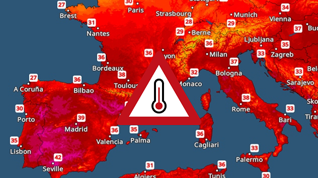
Temperature map showing very hot temperatures across the Mediterranean.
Thursday 7 August 2025

Holiday hot spots

Intense heat in the Mediterranean
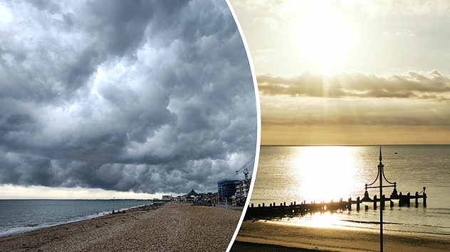
Split image. On the left - Thick, stormy clouds cover the sky at the coast. The sea is to the left with a beach taking centre frame. On the right - View of the North Sea with rays of sunlight streaming down over cloud.
Sunday 10 August 2025

Your weather - Your shots

Snaps from a stormy week
Shooting star shower
Tuesday 12 August 2025

Perseids overhead

Meteor shower reaches its peak
All weather news
This might also interest you
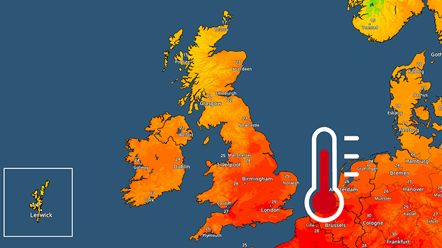
Temperature radar showing the UK and Ireland. A red thermometer is seen next to southern England where highs in the upper-20s can be seen.
Monday 11 August 2025

Breakfast brief

Beginning of the fourth heatwave
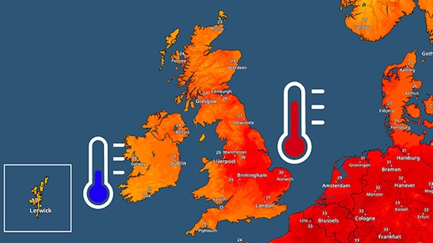
Temperature radar showing the UK and Ireland. Warmest in the east where a red thermometer is shown. Cooler in the west where a blue thermometer is shown.
Wednesday 13 August 2025

Breakfast brief

Cooler under clouds, still hot in places
Thursday 14 August 2025

Breakfast brief

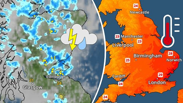
Thunderstorms and continued heat
All articles
Weather & Radar

www.weatherandradar.ie

facebooktwitteryouTubeContact uslinkList
Privacy Policy | Legal info | Accessibility statement