Home
Weather Dublin
WeatherRadar
RainfallRadar
TemperatureRadar
WindRadar
LightningRadar
Weather News
Editor's Pick
Discover the app
Weather widget
Contact us
Apps
Home / Weather News /

Live blog: Storm Noa impacts UK and Ireland

09:00
12 April 2023

Live blog
Storm Noa impacts UK and Ireland

Storm Noa

Storm Noa, named by Météo France, is impacting the UK and Ireland. Stay up to date with us right here.

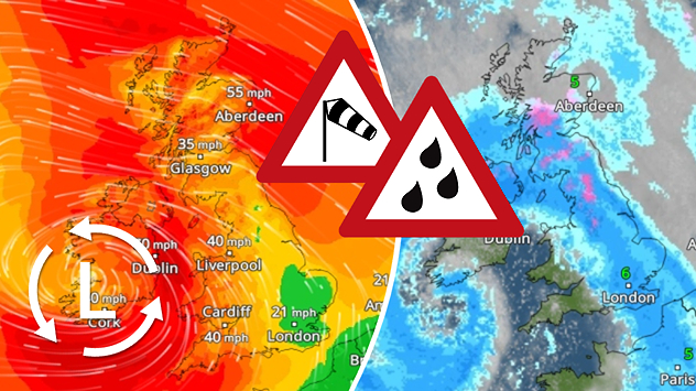
This deep area of low pressure that drove in spells of heavy rain on Tuesday night is now wrapping itself around the outside of the UK and Ireland, with inner bands of rain pushing into Wales, south-west England and the outskirts of Ireland.

This precipitation will be turning wintry over the hills, where there could be some minor accumulations across parts of Scotland, the Pennines and Welsh hills.

Strong winds through Wednesday too, with southern fringes of England, in addition to the south and west coast of Wales seeing peak gusts in excess of 60 or 65 mph. For Devon and Cornwall, and the west coast of Ireland, gusts could reach over 70 mph.

As this low tracks eastwards during Wednesday afternoon, thundery bands of rain will push in, bringing a risk of torrential downpours, thunder, lightning and hail, in addition to particularly gusty winds embedded within.

It might be nearly mid-April but the strength of the wind will deliver a bitter chill, so don't leave home without your coat today!

The winds and rain will then eventually ease off into the evening and overnight period, albeit for a concentrated area of strong winds across Merseyside, Lancashire and south-west Cumbria in particular.

Peak gusts so far (4pm update)

  • 96 mph Needles Old Battery
  • 82 mph Isle of Wight
  • 79 mph St Bees Head
  • 74 mph Isle of Portland
  • 71 mph Mumbles Head
  • 70 mph Pembrey Sands

Impacts

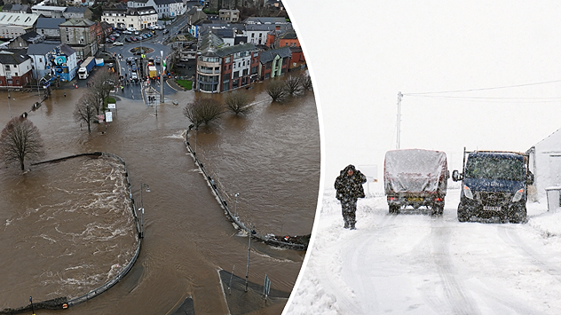
There are currently 17 flood alerts issued across southern England with an additional 3 warnings covering the Central and Tayside regions of Scotland.

Some areas of Ireland and Wales have seen snowfall though this was short lasting and rain now dominates the scene.

Settings for external content

Privacy policy
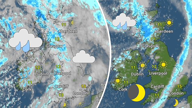
Thunderstorms are expected Wednesday afternoon, particularly from midday in northern England. Watch lightning strikes as they happen on the LightningRadar!

Afternoon update

Storm Noa has resulted in widespread power cuts, primarily across southern Wales and southwest England, while in Ireland hundreds of properties are without power in the south and along the exposed western coast.

Other areas have been impacted too, with over 17,000 properties losing power throughout the day across Lancashire and Cumbria. All but a few hundred of which have now been reconnected.

On the M62, news has emerged of an overturned HGV which was toppled by gusting winds as the system arrived Tuesday evening. There were minor injuries.

Weather & Radar editorial team
More on the topic
Split image showing a snow-covered coastal town under clear blue skies on the left, and fresh snowfall on the right with a parked car, falling snow, and muted rural background, divided by a curved white line.
Saturday 10 January 2026

Your weather - Your shots

Snowy and blustery week
Extreme temperatures of below minus 40 degrees were recorded in Lapland over the weekend. Such low temperatures are rare even there.
Tuesday 13 January 2026

Lapland ice chamber

Temperatures drop below -40 °C
Split image showing cars driving through heavy snowfall on a snow-covered road with low visibility on the left, and a UK weather radar on the right with blue and pink snow and rain bands, a low pressure system marked with an L, and snow icons near Ireland, divided by a curved white line.
Thursday 8 January 2026

Full impact overnight

Storm Goretti causing disruption
All weather news
This might also interest you
Weather map of the UK and Ireland showing scattered showers with cloudy patches across much of the region, especially around western and northern areas. Sunshine symbols appear over London, Cardiff, and parts of southern England, while temperatures range from 17°C to 18°C in most places. Areas of heavier rain are visible over the Atlantic to the west.
Friday 29 August 2025

Breakfast brief

Unsettled conditions into the weekend
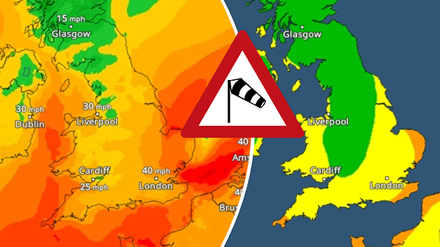
Split weather map showing UK wind speeds in orange-red shades up to 40 mph on the left and warning levels in green-yellow on the right, with a central wind warning sign.
Wednesday 22 October 2025

Warnings active

Storm Benjamin impacts the UK
Split weather map showing the UK and Ireland. The left side illustrates strong winds circulating around a low-pressure system, with gusts of 20–30 mph highlighted in orange and yellow. The right side shows radar imagery with widespread blue rain bands and patches of thunderstorms, especially over northern England and Scotland.
Thursday 28 August 2025

Breakfast brief

Remaining widely unsettled
All articles
Weather & Radar
IE
Clima & Radar Brasil
Hava durumu & Radar Türkiye
Időjárás és Radar Magyarország
Καιρός & Ραντάρ Ελλάδα
Météo & Radar Belgique (Français)
Météo & Radar France
Meteo & Radar Italia
Meteo & Radar România
Météo & Radar Suisse (Français)
Meteo & Radars Latvija
OrasOnline Lietuva
Počasí & Radar Czechia
Počasie & Radar Slovensko
Pogoda & Radar Polska
Погода & Радар Україна (українська)
Tempo & Radar Portugal
Tiempo & Radar Argentina
Tiempo & Radar España
Vejr & Radar Danmark
Vreme & Radar Slovenija
Vreme & Radar Srbija
Vrijeme & Radar Bosna
Vrijeme & Radar Crna Gora
Vrijeme & Radar Hrvatska
Време & Радар България
Времето & Радар Macedonia
Weather & Radar India (English)
Weather & Radar United Kingdom
Weather & Radar USA (English)
Weather & Radar USA (Español)
Weer & Radar België (Nederlands)
Weer & Radar Nederland

Weather & Radar is also available on

Google Play StoreApp Store

Company

Contact us Privacy Policy Legal info Accessibility statement

Services

Uploader

Socials

facebooktwitteryouTubelinkList