Home
Weather Dublin
WeatherRadar
RainfallRadar
TemperatureRadar
WindRadar
LightningRadar
Weather News
Editor's Pick
Discover the app
Weather widget
Contact us
Apps
    Home / Editor's Pick /

    Ice Age on the Baltic Sea - Permanent frost brings a frozen scene

11:23
4 February 2026

Ice Age on the Baltic Sea
Permanent frost brings a frozen scene

1/10
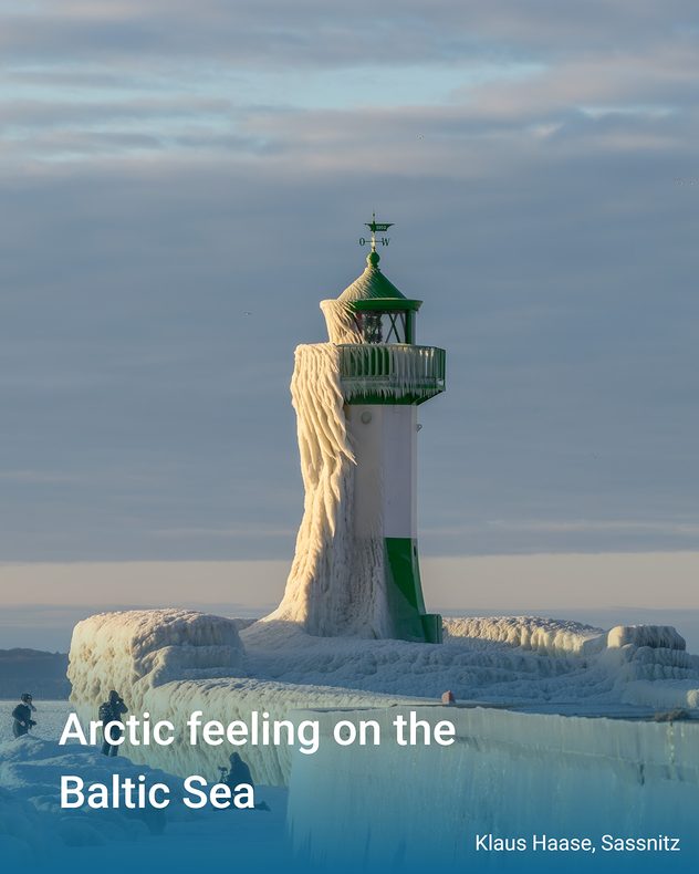
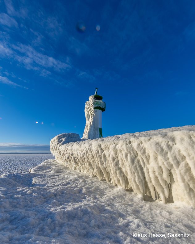
A landmark in a state of emergency. Frozen spray has created fascinating ice formations on the surf side of the Sassnitz lighthouse on Rügen.

The Baltic Sea has fallen silent. Where waves usually crash, the cold has silenced the sea.

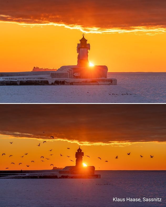
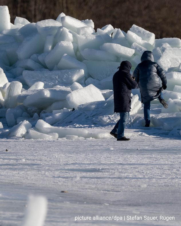
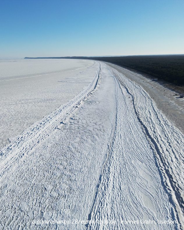
Our photo gallery shows impressive images of ice in Sassnitz on Rügen: metre-high floes, bizarrely frozen rocks, and a lighthouse enveloped in ice like a cloak.

Cold weather persists for days

The cause is a period of frost that has persisted over Central Europe for days. Icy air from Northern and Eastern Europe has mainly affected the north and east of Germany and parts of Poland, causing continuous frost there.

This has led to the formation of huge areas of ice in sheltered coastal areas on the southern Baltic Sea.

As impressive as this natural spectacle is, the weather conditions pose challenges, especially for shipping. Icebreakers are in operation in coastal waters to enable supply trips. Ferry connections have been restricted or temporarily suspended, and some islands are only accessible to a limited extent.

Icy Baltic

It is very rare for the Baltic Sea to freeze over. Extensive ice formation has only occurred in recent decades during particularly harsh winters, such as in 1947, 1962/63, 1978/79, 1986/87 and 1995/96. In these years, permafrost and very low temperatures persisted for weeks.

Click here for the TemperatureRadarIt remains cold in the northeast
Weather & Radar editorial team
More on the topic
Europe’s seas are unusually warm. Up to 30 degrees. . . Friday 31 July 2026
Friday 31 July 2026

Up to 30 degrees

Europe’s seas are unusually warm
Stronger winds make a return. Low pressure influence. . . Tuesday 4 August 2026
Wind forecast map of the UK and Ireland showing a low-pressure system north of Scotland, a windsock icon highlighting blustery conditions, and widespread winds of 30–40 mph across the British Isles, with the strongest winds around Ireland and northern Britain.
Tuesday 4 August 2026

Low pressure influence

Stronger winds make a return
Forest fires spread to south-east Europe. Heat and strong winds. . . Thursday 30 July 2026
Split image showing an active wildfire with flames and thick smoke on the left, and a wind forecast map of Greece on the right with gusts of 25–35 mph around the Aegean Sea, alongside a wildfire warning symbol highlighting elevated fire danger.
Thursday 30 July 2026

Heat and strong winds

Forest fires spread to south-east Europe
All weather news
This might also interest you
Super Typhoon Bavi threatens Taiwan. Up to 1,000 mm of rain. . Weather Videos. Wednesday 8 July 2026
The image shows an intense tropical cyclone over the western Pacific, east of Taiwan and the Philippines. The centre of the system is depicted as a light purple and white vortex with a clearly visible eye, surrounded by a ring of red and orange areas indicating the strongest wind speeds. A white arrow marks the typhoon’s predicted track towards the north-west, in the direction of Taiwan. To the west of the storm lie the Philippines, with the cities of Manila and Cebu; to the north of these lies Taiwan, with Taipei. Further west, the Chinese coast, including Hong Kong, and parts of Vietnam can be seen. The coloured wind map shows predominantly green areas outside the storm’s core, indicating significantly weaker winds. White streamlines illustrate the typhoon’s anti-clockwise circulation in the Northern Hemisphere. The highest wind speeds are concentrated around the eye of the cyclone.
Weather VideosWednesday 8 July 2026

Up to 1,000 mm of rain

Super Typhoon Bavi threatens Taiwan
New records for England and Wales. Broken again tomorrow?. . . Thursday 25 June 2026
Temperature map of southwest Britain on 25.06 showing extreme heat across southern Wales and southwest England, with Bute Park in Cardiff highlighted at 34.2°C and Yeovilton at 36.4°C amid widespread deep red heat zones.
Thursday 25 June 2026

Broken again tomorrow?

New records for England and Wales
Storm Chandra makes impact. Severe gales & heavy rain. . . Tuesday 27 January 2026
Split image showing strong winds over the UK on a forecast map and widespread rain and snow on a weather radar map.
Tuesday 27 January 2026

Severe gales & heavy rain

Storm Chandra makes impact
All articles
Weather & Radar

Weather & Radar is also available on

Google Play StoreApp Store

Company

Contact us Privacy Policy Legal info Accessibility statement

Services

Uploader

Socials

facebooktwitteryouTubelinkList