Home
Weather Dublin
WeatherRadar
RainfallRadar
TemperatureRadar
WindRadar
LightningRadar
Weather News
Editor's Pick
Discover the app
Weather widget
Contact us
Apps
    Home / Editor's Pick /

    What to do now - Preparing for the storm

17:00
22 October 2026

What to do now
Preparing for the storms

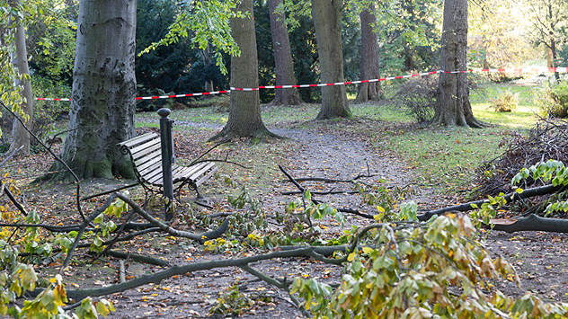
Fallen tree branches and green leaves cover a woodland path beside a bench, with red and white safety tape cordoning off the area.
With trees yet to lose their leaves, there's an additional danger in strong winds.

Storms Austen and Boelo are set to bring severe gales and heavy rain. There's plenty to do to prepare if you are in a warning area.

Adjust your outdoor plans

Planning an autumnal walk in the woods? Many trees still have their leaves, catching more wind. Even moderately strong gusts could cause branches to break or trees to fall. Avoid forests or other heavily wooded areas until the storm passes.

Prepare your garden

Bring loose items such as flowerpots, garden furniture, and parasols indoors, or secure them firmly. Don't forget your wheelie bins! Check that fences, garden gates, and other potentially loose structures are properly secured.

Remember the car and balcony

If you live in an apartment, check your balcony for anything that could blow away. During stormy weather, avoid parking your car beneath large trees, as falling branches can cause considerable damage.

Keep an eye on the WindRadar regularly over the coming days as Austen and Boelo move through.

Weather & Radar editorial team

More on the topic

Storm Austen approaches. What to expect tonight. . Weather Videos. Thursday 22 October 2026
Split image showing a wind map with 65 mph near Brest and a swirling storm south of England, beside a man wearing glasses and holding a microphone.
Weather VideosThursday 22 October 2026

What to expect tonight

Storm Austen approaches
Shooting stars from the Orionids peak. Mixed visibility overnight. . . Wednesday 21 October 2026
Split image showing a bright green meteor streaking across a starry night sky beside a UK weather map with rain over Scotland and southern England.
Wednesday 21 October 2026

Mixed visibility overnight

Shooting stars from the Orionids peak
Winds grow and rain spreads Wednesday. Prelude to Austen. . . Wednesday 21 October 2026
Split weather map showing strong winds up to 40 mph across southern Britain and blue rain bands over Scotland, Ireland and England, with warning symbols.
Wednesday 21 October 2026

Prelude to Austen

Winds grow and rain spreads Wednesday
All weather news

This might also interest you

Seasonal warmth between spring thunder. Your weather - Your shots. . . Sunday 19 April 2026
Split image showing coastal sunset with layered lenticular clouds over rooftops and palm trees on the left, and a green valley with river and hills under soft daylight on the right.
Sunday 19 April 2026

Your weather - Your shots

Seasonal warmth between spring thunder
A stormy week in the skies above. Your weather - Your shots. . . Sunday 30 August 2026
Split image showing lightning branching beneath dark storm clouds above rooftops on the left and an orange-pink sunset over a calm sea on the right.
Sunday 30 August 2026

Your weather - Your shots

A stormy week in the skies above
Bright and warm conditions take hold. Spring-like outlook. . . Thursday 23 April 2026
Split UK map showing warm temperatures up to 21 degrees in orange on the left and clear sunny conditions with temperatures from 12 to 18 degrees on the right, with sun icons across the country.
Thursday 23 April 2026

Spring-like outlook

Bright and warm conditions take hold
All articles
Weather & Radar

Weather & Radar is also available on

Google Play StoreApp Store

Company

Contact us Privacy Policy Legal info Accessibility statement

Services

Uploader

Socials

facebooktwitteryouTubelinkList