Home
Weather Dublin
WeatherRadar
RainfallRadar
TemperatureRadar
WindRadar
LightningRadar
Weather News
Editor's Pick
Discover the app
Weather widget
Contact us
Apps
    Home / Editor's Pick /

    Your weather - Your shots: Snowy and blustery week

12:00
10 January 2026

Your weather - Your shots
Snowy and blustery week

Elevated view of a coastal town blanketed in snow, with a formal park in the foreground, snow-covered streets and rooftops, terraced buildings to the right, and a clear blue sky overhead.
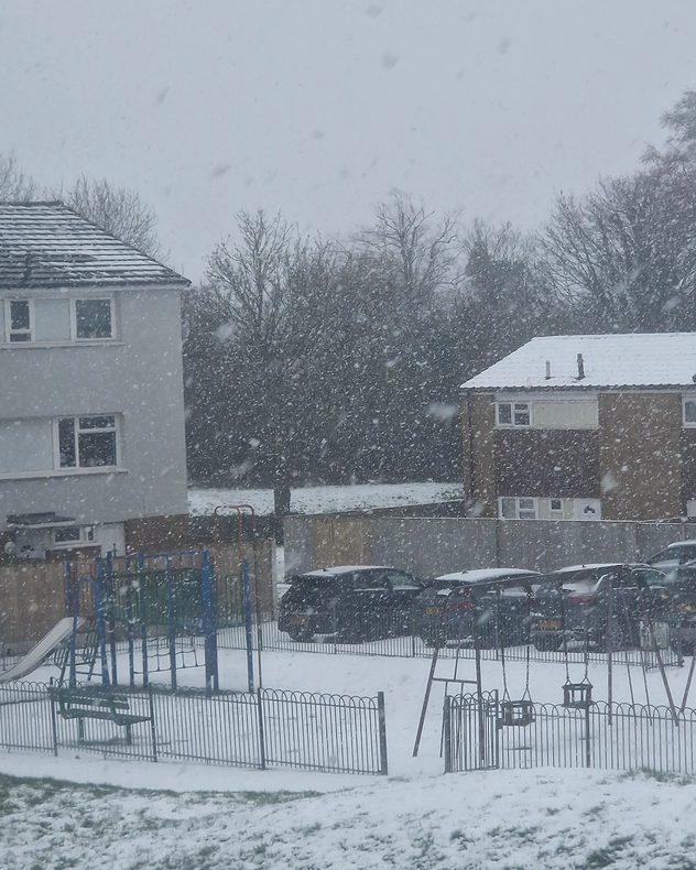
Heavy snow falling over a residential area with houses, parked cars, and a small fenced playground, as large snowflakes reduce visibility and coat roofs, trees, and the ground.
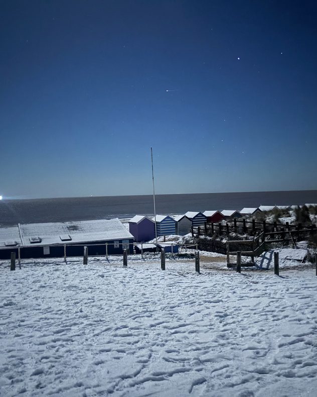
Snow-covered beach and promenade at night with a row of colorful beach huts, footprints in the snow, calm sea on the horizon, and a clear dark blue sky dotted with stars.
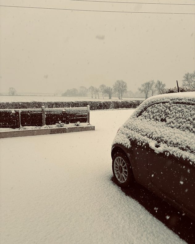
Snow falling steadily onto a parked car and driveway, with fresh snow covering the ground, hedges, and distant trees in a flat rural landscape under a pale overcast sky.
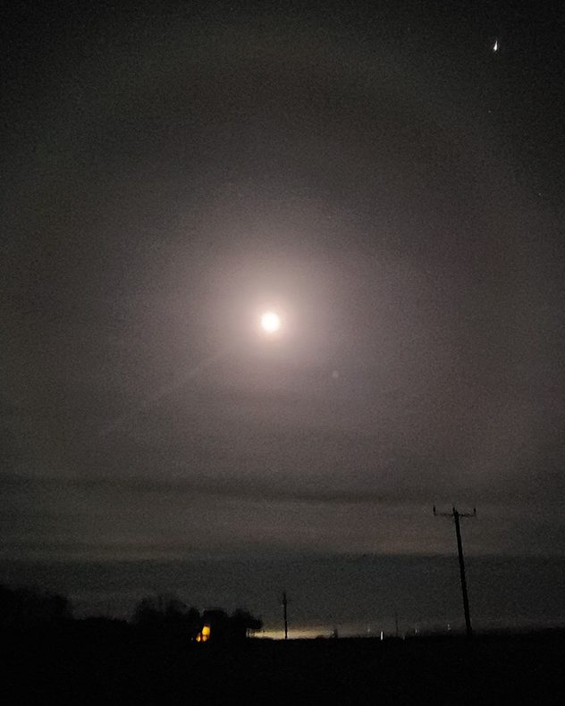
Bright full moon surrounded by a soft circular halo in a dark, hazy night sky, with faint stars visible and silhouettes of distant trees, rooftops, and utility poles along the horizon.
1/5
Fresh snow and blue skies in Lowestoft, Suffolk. - © Elaine High

Storm Goretti capped a cold, snowy week across the UK and Ireland. As always, caught on camera by you!

As winter takes a full grip, don't forget to send in your own shots for next week's collection and to appear on our social channels.

Just tap the image icon in the app, or use the uploaders for the UK or Ireland here.

Get involved! Using the Uploaderread more
Weather & Radar editorial team
More on the topic
Yet another typhoon in the Pacific. Gusts of over 185 mph. . . Friday 3 July 2026
Wind forecast map of the western Pacific showing a powerful typhoon east of Guam with a well-defined eye, strong wind circulation, and a windsock warning icon.
Friday 3 July 2026

Gusts of over 185 mph

Yet another typhoon in the Pacific
Cooler nights and lower dew points. Less oppressive heatwave. . . Thursday 9 July 2026
Split image showing the London skyline in hazy golden sunset light in the left and an overnight temperature map of the UK and Ireland on the right, with minimum temperatures ranging from 13°C in northeast Scotland to 18°C in southern England.
Thursday 9 July 2026

Less oppressive heatwave

Cooler nights and lower dew points
Heatwave versus storm system. Contrasts in Europe. . . Tuesday 7 July 2026
A temperature map of Europe showing a major heatwave in the south-west and significantly cooler air in the north. Two thermometer symbols illustrate the stark contrast in temperature.
Tuesday 7 July 2026

Contrasts in Europe

Heatwave versus storm system
All weather news
This might also interest you
A frozen start to the weekend. Icy conditions. . . Friday 13 February 2026
UK temperature map dated 14.02 showing widespread subzero values in blue shading, with readings such as −4 in Glasgow, −3 in Dublin, and −2 in London, alongside a blue thermometer icon.
Friday 13 February 2026

Icy conditions

A frozen start to the weekend
Storm Chandra makes impact. Severe gales & heavy rain. . . Tuesday 27 January 2026
Split image showing strong winds over the UK on a forecast map and widespread rain and snow on a weather radar map.
Tuesday 27 January 2026

Severe gales & heavy rain

Storm Chandra makes impact
Seasonal warmth between spring thunder. Your weather - Your shots. . . Sunday 19 April 2026
Split image showing coastal sunset with layered lenticular clouds over rooftops and palm trees on the left, and a green valley with river and hills under soft daylight on the right.
Sunday 19 April 2026

Your weather - Your shots

Seasonal warmth between spring thunder
All articles
Weather & Radar

Weather & Radar is also available on

Google Play StoreApp Store

Company

Contact us Privacy Policy Legal info Accessibility statement

Services

Uploader

Socials

facebooktwitteryouTubelinkList