Home
Weather Dublin
WeatherRadar
RainfallRadar
TemperatureRadar
WindRadar
LightningRadar
Weather News
Editor's Pick
Discover the app
Weather widget
Contact us
Apps
    Home / Editor's Pick /

    Your weather - Your shots: A spring break between storms

08:00
12 April 2026

Your weather - Your shots
A spring break between storms

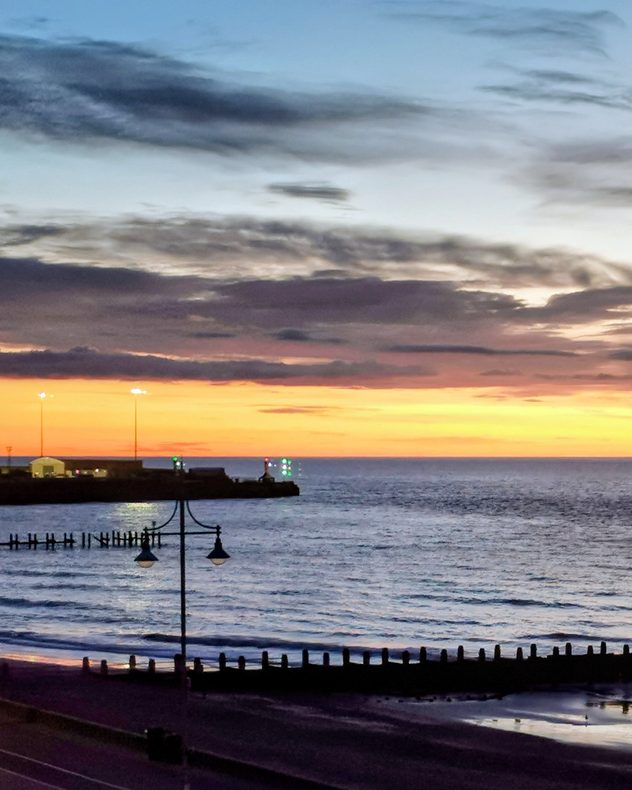
Sunrise over the North Sea at Lowestoft, Suffolk, with an orange and yellow horizon, calm waves, harbour lights in the distance, and silhouetted lampposts and groynes along the shore.
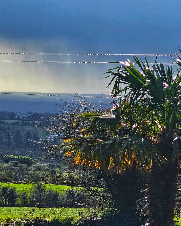
Sunlit countryside landscape with foliage in the foreground, green fields and hedgerows below with rain showers seen in the background.
Bright orange sunset low on the horizon with glowing sun partially obscured by silhouetted tree branches and a warm gradient sky.
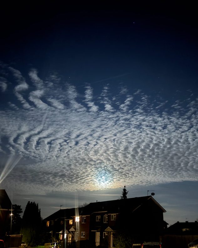
Rippled altocumulus cloud layer lit by moonlight forming a mackerel sky pattern above silhouetted houses, with textured wave-like clouds across a dark blue night sky.
Sunlit ruins of a historic stone abbey with tall broken walls and arched windows, set on green grass under a clear blue sky.
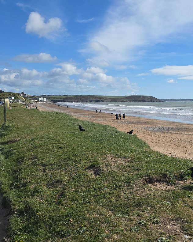
Sandy beach with gentle waves and scattered people walking along the shortline, bordered by grassy dunes in the foreground under a bright blue sky with scattered clouds.
1/6
Sunrise over the North Sea casts a warm glow over Lowestoft, Suffolk. - © Elaine High

Between Storm Dave and another unsettled weekend, there was plenty of sunnier, spring weather captured across the UK and Ireland.

We also have a clip from our new video feature, recorded on a spring walk through Kenilworth, Warwickshire.

Capture any of the stormy scenes? Or the quieter spells in between? Use our uploaders for the UK or Ireland to send in your pictures, or film your own weather moment with our new feature and let us see too!

Capture your weather, with our radar!read more
Weather & Radar editorial team
More on the topic
Autumn is setting in across Europe. Cooler, wetter and windier. . . Tuesday 6 October 2026
Weather maps show a sharp drop in temperature across Central Europe, accompanied by rain and thunderstorms.
Tuesday 6 October 2026

Cooler, wetter and windier

Autumn is setting in across Europe
Heavy rain builds through the day. Irish warnings issued. . . Thursday 8 October 2026
Weather map showing widespread heavy rain across western and central Ireland, with blue precipitation bands and a red triangular rain warning symbol.
Thursday 8 October 2026

Irish warnings issued

Heavy rain builds through the day
Wednesday washout for parts of England. Disruption possible. . . Tuesday 6 October 2026
Weather map showing heavy rain from London through eastern England toward Norwich, with a flood warning symbol over East Anglia.
Tuesday 6 October 2026

Disruption possible

Wednesday washout for parts of England
All weather news
This might also interest you
Bright and warm conditions take hold. Spring-like outlook. . . Thursday 23 April 2026
Split UK map showing warm temperatures up to 21 degrees in orange on the left and clear sunny conditions with temperatures from 12 to 18 degrees on the right, with sun icons across the country.
Thursday 23 April 2026

Spring-like outlook

Bright and warm conditions take hold
A stormy week in the skies above. Your weather - Your shots. . . Sunday 30 August 2026
Split image showing lightning branching beneath dark storm clouds above rooftops on the left and an orange-pink sunset over a calm sea on the right.
Sunday 30 August 2026

Your weather - Your shots

A stormy week in the skies above
Super Typhoon Bavi threatens Taiwan. Up to 1,000 mm of rain. . Weather Videos. Wednesday 8 July 2026
The image shows an intense tropical cyclone over the western Pacific, east of Taiwan and the Philippines. The centre of the system is depicted as a light purple and white vortex with a clearly visible eye, surrounded by a ring of red and orange areas indicating the strongest wind speeds. A white arrow marks the typhoon’s predicted track towards the north-west, in the direction of Taiwan. To the west of the storm lie the Philippines, with the cities of Manila and Cebu; to the north of these lies Taiwan, with Taipei. Further west, the Chinese coast, including Hong Kong, and parts of Vietnam can be seen. The coloured wind map shows predominantly green areas outside the storm’s core, indicating significantly weaker winds. White streamlines illustrate the typhoon’s anti-clockwise circulation in the Northern Hemisphere. The highest wind speeds are concentrated around the eye of the cyclone.
Weather VideosWednesday 8 July 2026

Up to 1,000 mm of rain

Super Typhoon Bavi threatens Taiwan
All articles
Weather & Radar

Weather & Radar is also available on

Google Play StoreApp Store

Company

Contact us Privacy Policy Legal info Accessibility statement

Services

Uploader

Socials

facebooktwitteryouTubelinkList