Home / Editor's Pick /

Winter gardening tips: How to protect your plants

10:30
24 November 2023

Winter gardening tips
How to protect your plants

frosty plant

With colder air setting in and the first widespread frost on the cards this weekend, here's how you can protect your plants.

As colder air arrives, plants, particularly tender or young seedlings, can be damaged by dramatic temperature drops. Even in autumn, or the first early winter cold snap, it can force more established plants to become dormant.

How we can help:

Keeping an eye on the weather forecast can help you to prepare for any impending cold weather.

Clear skies for example, will more likely lead to a ground frost, even when the air temperature is a few degrees above zero. This is particularly the case through winter, once the ground starts to lose its deep stored heat from the summer months.

Cloudier skies are better for protecting your plants, as clouds act like an enormous blanket overhead, preventing too much radiation to be lost back out to the atmosphere.

As for wind, calm conditions prevent air from mixing, so the denser, cold air is able to sink to the surface and make a frost more likely.

Of course low temperatures are also a key factor, but is most important in reference to the dew point.

If there is moisture present, then frost can form, but if the ground or grass temperature does not drop below the dew point, then even if it is sub-zero, it will remain frost-free and dry.

Here are a few key tips to help protect your plants from harsh weather conditions:

  • Bring some potted plants inside or move them to a more sheltered spot
  • Add a thick layer of mulch to your plant beds to act as an insulator
  • Purchase a fleece or blanket for your plants, or just simply use any fabric to drape over like a tent
  • Build a cold frame
  • Use a cloche, like a mini greenhouse
  • Water plants during the daytime; moist soil can hold more heat than dry soil
Frosts are likely to become a regular and widespread occurrence for most of us starting this week, so keep a close eye on the forecast and use our above tips to help prepare for a visit from Jack frost!

Weather & Radar editorial team
More on the topic
Flooded road with cars in the water. Next to it, a weather map with a warning symbol. Heavy rain causes regional flooding.
Tuesday 9 September 2025

Towns flooded

Heavy rain hits Europe
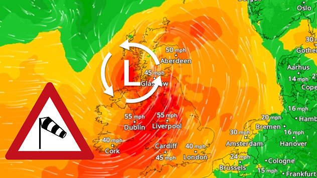
Split weather map of the UK and Ireland highlighting strong winds on Monday, 15 September. The left side shows gust speeds, with 55 mph around Dublin and Liverpool, and 45 mph near Cardiff and London, linked to a low-pressure system over the North Sea. The right side shows wind warning levels, with yellow (level 1) across much of England, Wales, and Northern Ireland, and orange (level 2) in western Ireland and parts of western Wales. A wind warning symbol is displayed in the centre.
Sunday 14 September 2025

Gales again

Continued warnings to start the week
Weather map showing low pressure over Iceland and jet stream over Europe.
Thursday 11 September 2025

Over the coming days

Jet stream brings unsettled weather
All weather news
This might also interest you
Wednesday 27 August 2025

Breakfast brief

Frontal system brings heavy rain
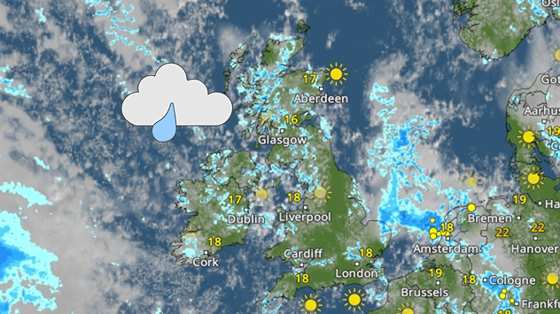
Weather map of the UK and Ireland showing scattered showers with cloudy patches across much of the region, especially around western and northern areas. Sunshine symbols appear over London, Cardiff, and parts of southern England, while temperatures range from 17°C to 18°C in most places. Areas of heavier rain are visible over the Atlantic to the west.
Friday 29 August 2025

Breakfast brief

Unsettled conditions into the weekend
Mammatus clouds
Thursday 21 August 2025

Unusual view

Mammatus clouds over Ireland
All articles
Weather & Radar

www.weatherandradar.ie

facebooktwitteryouTubeContact uslinkList
Privacy Policy | Legal info | Accessibility statement