Home / Weather News /

Storm Darragh named

09:57
5 December 2024

Impacts from Friday
Storm Darragh named

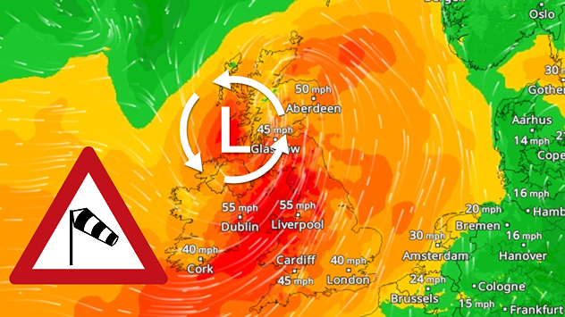
Gale force winds on Wind Radar as Storm Darragh impacts the UK and Ireland. Gales across the UK and Ireland as Storm Darragh arrives.

Storm Darragh, the third named storm in three weeks, has been named.

The system is expected to develop to our west on Friday, with its centre then moving across Ireland and northern England before it slows down late on Saturday while moving south-east to Belgium.

This storm track is rather unusual as most Atlantic systems tend to move southwest-northeast. Storm Darragh means different issues for different parts of the UK and Ireland through the next couple of days.

The biggest impacts are likely to result from strong winds and severe coastal gales. At the same time, heavy rain may bring the risk of some flooding across parts of Wales in particular, with more than 50 mm falling here through early Sunday. Higher parts of Scotland and northern England could see some snow at times.

AreaMost likely peak gusts
Western parts of Ireland70 to 80 mph
Coastal areas in NW SW England and Wales75 to 90 mph
Coastal E England65 to 75 mph
Elsewhere / inland areas55 to 65 mph
Currently expected peak wind speeds Friday night and Saturday

While winds will first be mainly from a southerly or southwesterly direction, the strongest gusts are likely to be from the northwest or north which happens less often. This means that there may be more disruption from e.g. falling trees as they are more susceptible to suffer damage with winds from that direction.

The long period of high winds is also likely to cause rising water levels along many coasts, first around the Irish Sea and the Bristol Channel, then chiefly along North Sea coasts from Lincolnshire to Kent later on. Large waves and high sea water levels may cause some flooding and isolated damage in prone areas.

Be sure to check back for further updates or changes to the forecast. See how the storm will affect where you are on the WindRadar.

Ryan Hathaway
More on the topic
Split image showing cars driving through heavy snowfall on a snow-covered road with low visibility on the left, and a UK weather radar on the right with blue and pink snow and rain bands, a low pressure system marked with an L, and snow icons near Ireland, divided by a curved white line.
Thursday 8 January 2026

Full impact overnight

Storm Goretti causing disruption
On the left, a wind map shows hurricane-force winds over the English Channel. On the right, snow and strong winds hamper visibility on a road.
Friday 9 January 2026

Power failures and damage

Storm Goretti hits Europe
Split image shows high level wind warnings during Storm Éowyn on the left, and noctilucent clouds on the right.
Tuesday 30 December 2025

January to June

2025: The year in weather
All weather news
This might also interest you
Sunday 24 August 2025

Your weather - Your shots

Mammatus clouds widely spotted
Split weather map showing UK wind speeds in orange-red shades up to 40 mph on the left and warning levels in green-yellow on the right, with a central wind warning sign.
Wednesday 22 October 2025

Warnings active

Storm Benjamin impacts the UK
Monday 25 August 2025

Bank holiday outlook

Warm day turning gusty in places
All articles
Weather & Radar

Weather & Radar is also available on

Google Play StoreApp Store

Company

Contact us Privacy Policy Legal info Accessibility statement

Services

Uploader

Socials

facebooktwitteryouTubelinkList