Home
Weather Dublin
WeatherRadar
RainfallRadar
TemperatureRadar
WindRadar
LightningRadar
Weather News
Editor's Pick
Discover the app
Weather widget
Contact us
Apps
    Home / Editor's Pick /

    Staying fairly blustery across Ireland

09:46
29 October 2026

Autumn greetings
Staying fairly blustery across Ireland

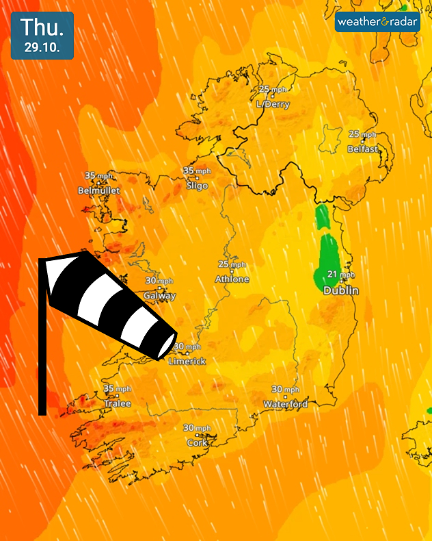
Wind forecast for Thursday 29.10 showing 35 mph near Belmullet, Sligo, and Tralee, with orange wind zones and a large windsock symbol.
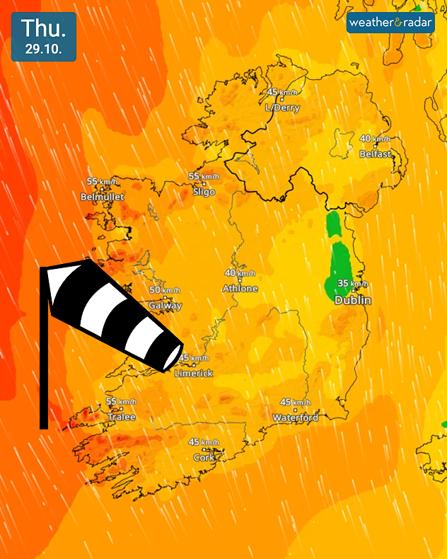
Wind forecast for Thursday 29.10 showing 55 km/h near Belmullet, Sligo, and Tralee, with orange wind zones and a large windsock icon.
1/2
Thursday's WindRadar stays active across Ireland.

While the stormy winds have faded away, it's still going to be a blustery few days across Ireland.

As is typical, the west of the country sees the strongest gusts, reaching up to 35 mph (55 km/h) in the day for Belmullet. Overnight, these strengthen slightly with gusts of around 40 mph (60 km/h) along the west coast.

Similarly blustery conditions will be felt in the west of Scotland and growing in the south-west of England through the day.

Keep an eye on the gustsWindRadar
Ryan Hathaway

More on the topic

Severe weather risk in the Mediterranean. Turkey and Greece. . . Tuesday 27 October 2026
Weather map showing low pressure over the Aegean Sea, blue rain bands across Greece and Turkey, and heavy rain and thunderstorm warning symbols.
Tuesday 27 October 2026

Turkey and Greece

Severe weather risk in the Mediterranean
Calmer autumn views on a stormy week. Your weather - Your shots. . . Sunday 25 October 2026
Split image showing swirling orange-pink sunset clouds above green countryside and golden wispy clouds over a tree-lined car park.
Sunday 25 October 2026

Your weather - Your shots

Calmer autumn views on a stormy week
Preparing for the storms. What to do now. . . Thursday 22 October 2026
Split image showing Storm Austen winds up to 65 mph near Brest and 55 mph near Plymouth, alongside fallen tree branches on a cordoned-off park path.
Thursday 22 October 2026

What to do now

Preparing for the storms
All weather news

This might also interest you

Historic Storm Éowyn arrives. On this day.... . . Saturday 24 January 2026
Split image showing a person in a yellow jacket struggling against strong winds and heavy rain on a street at night on the left, and an Irish wind forecast map on the right with red and purple shading, gusts up to 75 mph, and a wind warning icon, divided by a curved white line.
Saturday 24 January 2026

On this day...

Historic Storm Éowyn arrives
Storm Chandra makes impact. Severe gales & heavy rain. . . Tuesday 27 January 2026
Split image showing strong winds over the UK on a forecast map and widespread rain and snow on a weather radar map.
Tuesday 27 January 2026

Severe gales & heavy rain

Storm Chandra makes impact
Flooding, gales, and heavy snow. Storm Chandra. . . Tuesday 27 January 2026
Split image showing aerial flooding in a town with muddy water covering roads on the left, and a rural road on the right blocked by heavy snowfall with vans stopped and a person walking in snow.
Tuesday 27 January 2026

Storm Chandra

Flooding, gales, and heavy snow
All articles
Weather & Radar

Weather & Radar is also available on

Google Play StoreApp Store

Company

Contact us Privacy Policy Legal info Accessibility statement

Services

Uploader

Socials

facebooktwitteryouTubelinkList