Home
Weather Dublin
WeatherRadar
RainfallRadar
TemperatureRadar
WindRadar
LightningRadar
Weather News
Editor's Pick
Discover the app
Weather widget
Contact us
Apps
    Home / Editor's Pick /

    Severe weather on the Adriatic coast - Rain, storms and snow

13:00
12 November 2026

Rain, storms and snow
Severe weather on the Adriatic coast

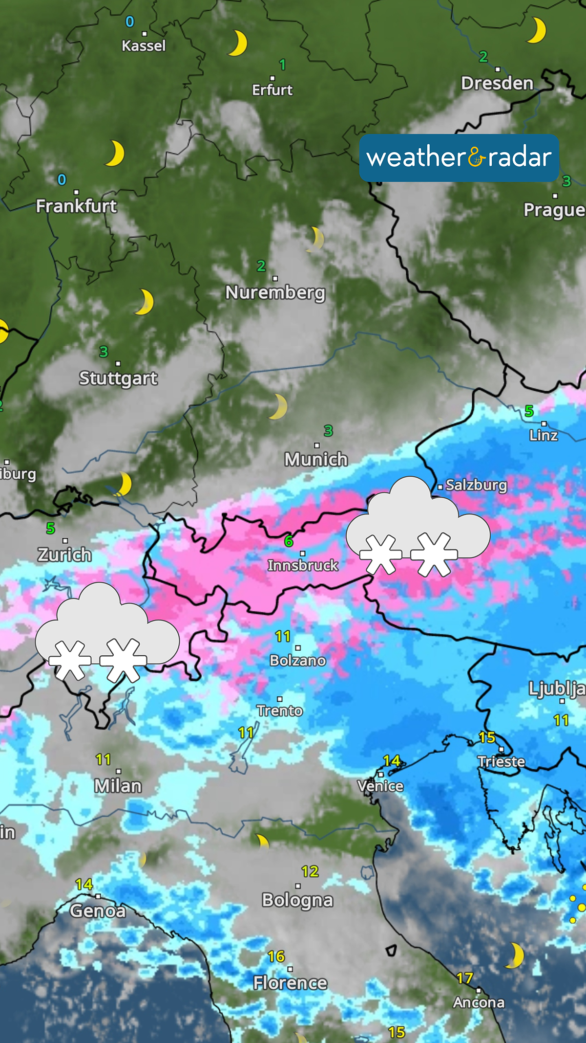
Storm Charles has already caused damage in Portugal and Spain and is now moving across Italy and the Adriatic.

From Genoa via Venice to Croatia, there will be heavy, and in some cases prolonged, rainfall today and tomorrow.

By Friday evening, widespread rainfall of 20 to 50 mm is expected. In the Julian Alps and the Croatian coastal mountains, rainfall of more than 300 mm is even possible. There is a risk of flooding and high water levels. In addition, gusts of wind reaching 43 to 62 mph are sweeping across the country and may even uproot trees.

Plenty of snow in the Alps

The WeatherRadar forecast shows widespread snowfall in the Alps overnight on Friday.

In the Alps, the low-pressure system is also bringing a fair amount of snow. From around 1,000 metres, a layer of snow several centimetres thick may form. In the north, the snow line will drop as low as 600 metres, although the snow is not expected to settle there.

Weather & Radar editorial team

More on the topic

Sunshine returns as gloom lifts. Brighter days ahead. . . Wednesday 11 November 2026
Weather map showing widespread sunshine across the UK and Ireland, scattered wintry showers over northern Scotland and the North Sea, and temperatures of 6 to 9°C.
Wednesday 11 November 2026

Brighter days ahead

Sunshine returns as gloom lifts
Meteor shower peaks with mixed visibility. Better view Thursday. . . Wednesday 11 November 2026
Split image showing a UK weather map with temperatures of 0–7°C and snow showers in Scotland, beside a bright meteor streak in a starry night sky.
Wednesday 11 November 2026

Better view Thursday

Meteor shower peaks with mixed visibility
Further fog disruption expected. Growing dense overnight. . . Monday 9 November 2026
Weather map showing widespread fog across the English Midlands, with a red fog warning symbol near Nottingham and temperatures of 4–6°C.
Monday 9 November 2026

Growing dense overnight

Further fog disruption expected
All weather news

This might also interest you

New records for England and Wales. Broken again tomorrow?. . . Thursday 25 June 2026
Temperature map of southwest Britain on 25.06 showing extreme heat across southern Wales and southwest England, with Bute Park in Cardiff highlighted at 34.2°C and Yeovilton at 36.4°C amid widespread deep red heat zones.
Thursday 25 June 2026

Broken again tomorrow?

New records for England and Wales
Flooding, gales, and heavy snow. Storm Chandra. . . Tuesday 27 January 2026
Split image showing aerial flooding in a town with muddy water covering roads on the left, and a rural road on the right blocked by heavy snowfall with vans stopped and a person walking in snow.
Tuesday 27 January 2026

Storm Chandra

Flooding, gales, and heavy snow
A stormy week in the skies above. Your weather - Your shots. . . Sunday 30 August 2026
Split image showing lightning branching beneath dark storm clouds above rooftops on the left and an orange-pink sunset over a calm sea on the right.
Sunday 30 August 2026

Your weather - Your shots

A stormy week in the skies above
All articles
Weather & Radar

Weather & Radar is also available on

Google Play StoreApp Store

Company

Contact us Privacy Policy Legal info Accessibility statement

Services

Uploader

Socials

facebooktwitteryouTubelinkList