Home / Weather News /

Quick warming temps, no snow - How soon could Winter Olympics be reduced to 1 city?

01:00
10 February 2022

Warming Winter Olympics Games
How soon could they be hosted by 1 city?

Olympic Winter Games shutterstock

2021 was the warmest year in China's history. China’s capital Beijing had its own hot record as February 2021 was marked by extreme heat, setting a record when the temperature rose 4 degrees above normal.

Yes, this might be data from last year, but the trend does not give much hope. For example, since 1950, temperatures in Beijing have warmed during february.

Beijing 2022 makes history with 100% artificial snow

China's capital was unable to accumulate much snow during the months before the start of the 2022 Olympics, so they turned to create artificial snow for the event. And while artificial snow has been used since the 1980 games, it has become more common in recent years. In fact, most of the snow we see this year in Beijing is completely artificial, except for the snow that could fall during the event itself.

How much are the Winter Olympic games warmed?

Since 1950, temperatures have risen drastically, and in many regions, the most affected temperatures are those of the winter season. Climate Central, a nonprofit climate organization, looked at the 19 cities that have hosted the Winter Olympics since 1950. On average these cities have warmed 4.8 degrees since 1950.

The cities that have seen the largest increase in temperatures in February since 1950 are Oslo (hosted in 1952) and Lillehammer (hosted in 1994)in Norway, with an increase of 5 degrees. This heating marks big differences in phenomena necessary for the games, such as the formation of snow.

According to a study by researchers at the University of Waterloo in Canada, four cities, (Sochi, Squaw Valley, Chamonix, Garmisch-Partenkirchen) that have been hosts are already not capable of sustaining the right atmospheric conditions in February to host the Olympic Games.

Settings for external content

Privacy policy
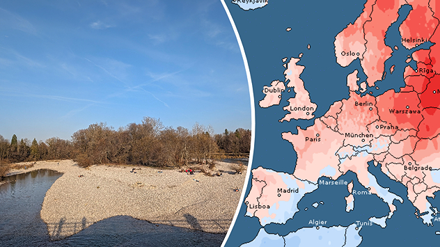
If we fail to reduce greenhouse gas emissions, according to the points agreed in the Paris Agreement, there will only be 4 previous Winter Olympics cities left capable of having safe and fair conditions for the games during the 2050s, and only the city of Sapporo, Japan, host of the 1972 Olympics, would continue to have them for a decade of 2080.

Weather & Radar editorial team
More on the topic
Weather & Radar's weather radar map shows a blocking omega weather pattern: a stable high-pressure system over Great Britain (H), flanked by two low-pressure systems (T), creates a typical pattern for persistent grey weather in autumn and winter.
Tuesday 14 October 2025

Current weather setup

Omega high brings persistent grey skies
Weather map showing high pressure over Western Europe and clouds over Central Europe.
Wednesday 8 October 2025

Omega block

Pressure over UK shapes Europe's weather
Two typhoons are moving across the western Pacific Ocean towards Japan. Halong is located east of Tokyo and Nakri is south of Tokyo. The coloured areas indicate the intensity of the storm.
Thursday 9 October 2025

Busy in the Pacific

Tropical storms near the Japanese coast
All weather news
This might also interest you
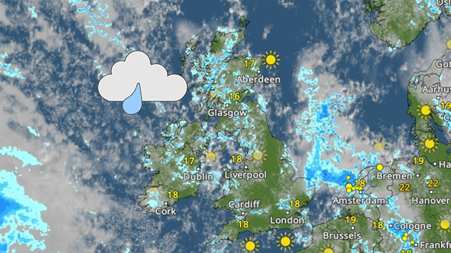
Weather map of the UK and Ireland showing scattered showers with cloudy patches across much of the region, especially around western and northern areas. Sunshine symbols appear over London, Cardiff, and parts of southern England, while temperatures range from 17°C to 18°C in most places. Areas of heavier rain are visible over the Atlantic to the west.
Friday 29 August 2025

Breakfast brief

Unsettled conditions into the weekend
Weather map showing a split in north-south conditions of the UK. Scotland sees widespread cloud cover while England and Wales have clear skies.
Friday 15 August 2025

Clouds on the move

North-south split in conditions
Split weather map showing the UK and Ireland. The left side illustrates strong winds circulating around a low-pressure system, with gusts of 20–30 mph highlighted in orange and yellow. The right side shows radar imagery with widespread blue rain bands and patches of thunderstorms, especially over northern England and Scotland.
Thursday 28 August 2025

Breakfast brief

Remaining widely unsettled
All articles
Weather & Radar

www.weatherandradar.ie

facebooktwitteryouTubeContact uslinkList
Privacy Policy | Legal info | Accessibility statement