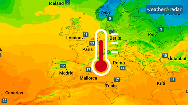
Home
Weather Dublin
WeatherRadar
RainfallRadar
TemperatureRadar
WindRadar
LightningRadar
Weather News
Editor's Pick
Discover the app
Weather widget
Contact us
Apps
Home / Editor's Pick /

Gusty in the UK & Ireland: Storms bring warmth to Europe

23:00
4 December 2025

Gusty in the UK & Ireland
Storms will soon bring spring air

At the beginning of next week, very mild air will reach us with temperatures more reminiscent of spring than winter.

Temperatures across much of Europe are set to rise significantly again in the near future, thanks to storm fronts over the Atlantic reaching the UK and Ireland.

These will draw in very mild air from the weekend onwards and direct it straight towards Europe from Friday, with strong winds across the two countries.

Already noticeably milder in south-western EuropeTemperature radar for Saturday

At the start of the second week of December, temperatures in Central Europe will reach 10 to 15 degrees Celsius. In South-Western Europe, it will be warm, with temperatures ranging from 15 to 20 degrees Celsius.

In some areas, such as the Spanish Mediterranean coast, peak temperatures may even exceed these levels.

As things stand at present, the spring-like air is likely to remain in many regions throughout the week.

Barcelona

Su
10
22
Mo
7
22
Tu
9
21
We
10
24
Th
13
22
Fr
11
19
Sa
11
19
Su
9
17
Mo
11
19
Tu
12
20
We
14
22
Th
13
21
Fr
13
21
Sa
13
21
Max (°C)
Min (°C)
moreless

Paris

Su
3
18
Mo
6
24
Tu
9
24
We
7
22
Th
6
12
Fr
8
18
Sa
7
16
Su
5
14
Mo
7
16
Tu
7
15
We
7
15
Th
7
15
Fr
8
16
Sa
8
16
Max (°C)
Min (°C)
moreless

Frankfurt

Su
3
16
Mo
2
19
Tu
3
19
We
4
19
Th
6
11
Fr
4
15
Sa
5
16
Su
5
14
Mo
7
15
Tu
8
16
We
7
15
Th
6
15
Fr
8
16
Sa
7
15
Max (°C)
Min (°C)
moreless

London

Su
1
15
Mo
4
20
Tu
7
23
We
8
14
Th
5
15
Fr
5
17
Sa
7
15
Su
6
14
Mo
8
15
Tu
7
15
We
6
15
Th
8
16
Fr
8
16
Sa
8
16
Max (°C)
Min (°C)
moreless

Dublin

Su
4
12
Mo
8
15
Tu
10
14
We
6
10
Th
4
16
Fr
4
12
Sa
5
10
Su
2
10
Mo
5
11
Tu
5
11
We
4
12
Th
3
12
Fr
5
13
Sa
6
12
Max (°C)
Min (°C)
moreless
Dr. Bernd Maurer
Ryan Hathaway
More on the topic
Split weather graphic showing breezy conditions across the UK and Ireland on the left with winds around 25–30 mph, and a rain band moving east across Ireland into Britain on the right.
Tuesday 31 March 2026

Unsettled midweek

Wet & windy Wednesday for some
Left: Weather radar from Monday evening – Right: The corresponding wind radar
Wednesday 1 April 2026

Air quality dropping

Saharan dust coats the Canaries
Wind map of the UK and Ireland showing a deep low-pressure system, Storm Dave, with red-orange zones and strong gusts up to 55 mph, plus a windsock warning icon indicating hazardous conditions.
Saturday 4 April 2026

Severe overnight gales

Storm Dave makes impact
All weather news
This might also interest you
Illustration of white and yellow fireworks on a blue background.
Wednesday 31 December 2025

Hello 2026

Happy New Year
Weather map of the UK and Ireland showing scattered showers with cloudy patches across much of the region, especially around western and northern areas. Sunshine symbols appear over London, Cardiff, and parts of southern England, while temperatures range from 17°C to 18°C in most places. Areas of heavier rain are visible over the Atlantic to the west.
Friday 29 August 2025

Breakfast brief

Unsettled conditions into the weekend
Split image showing aerial flooding in a town with muddy water covering roads on the left, and a rural road on the right blocked by heavy snowfall with vans stopped and a person walking in snow.
Tuesday 27 January 2026

Storm Chandra

Flooding, gales, and heavy snow
All articles
Weather & Radar

Weather & Radar is also available on

Google Play StoreApp Store

Company

Contact us Privacy Policy Legal info Accessibility statement

Services

Uploader

Socials

facebooktwitteryouTubelinkList