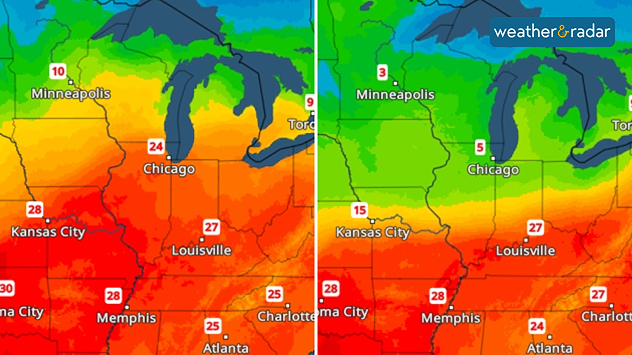
Home
Weather Dublin
WeatherRadar
RainfallRadar
TemperatureRadar
WindRadar
LightningRadar
Weather News
Editor's Pick
Discover the app
Weather widget
Contact us
Apps
Home / Editor's Pick /

From 25, to 5 degrees - USA: Temperatures are up and down

10:00
31 March 2026

From 25, to 5 degrees
USA: Temperatures are up and down

A sharp drop in temperature is on the way in parts of the US. Today, Chicago is still hovering around 25 degrees, but tomorrow temperatures will suddenly plummet to around 5 degrees.

A sharp drop in temperatures is on the way in the US. Maximum temperatures for today (left) and tomorrow (right).

After that, the temperature will shoot back up again, just like on a rollercoaster. By Thursday, the thermometer will be showing around 20 degrees again.

Chicago

Tu
19
23
We
4
6
Th
6
22
Fr
9
15
Sa
12
16
Su
1
5
Mo
1
9
Tu
4
12
We
4
12
Th
10
18
Fr
10
18
Sa
9
16
Su
9
16
Mo
6
13
Max (°C)
Min (°C)
moreless

New York

Tu
16
26
We
16
28
Th
9
9
Fr
5
21
Sa
15
27
Su
16
23
Mo
7
15
Tu
5
13
We
4
12
Th
5
13
Fr
9
18
Sa
11
19
Su
11
19
Mo
10
19
Max (°C)
Min (°C)
moreless

Boston

Tu
9
15
We
5
23
Th
4
4
Fr
3
20
Sa
16
25
Su
8
22
Mo
7
14
Tu
3
11
We
3
11
Th
2
11
Fr
6
17
Sa
11
19
Su
9
18
Mo
7
16
Max (°C)
Min (°C)
moreless

Philadelphia

Tu
17
27
We
17
29
Th
10
10
Fr
6
26
Sa
16
29
Su
19
26
Mo
7
15
Tu
5
13
We
5
13
Th
5
16
Fr
9
20
Sa
12
21
Su
10
22
Mo
12
23
Max (°C)
Min (°C)
moreless

Of course, this sudden drop in temperature won’t come without consequences. Things are set to get pretty rough, particularly in Iowa and northern Illinois: expect severe thunderstorms with heavy rain, hail and gusts of wind, and even the odd supercell.

On Thursday, the cold snap will reach the east coast: temperatures in New York will drop to 8 degrees, whilst in Boston they’ll be as low as a mere 4 degrees.

Glossary: What is a supercell?read more
Sebastian Keßler
More on the topic
On the left is the weather radar showing snowfall in the Alps; on the right is a wintry mountain landscape.
Wednesday 25 March 2026

Plenty of fresh snow

A return to winter in the Alps
Split weather graphic showing breezy conditions across the UK and Ireland on the left with winds around 25–30 mph, and a rain band moving east across Ireland into Britain on the right.
Tuesday 31 March 2026

Unsettled midweek

Wet & windy Wednesday for some
Close-up of a clock face overlaid on a golden sunrise sky, symbolizing time change and longer daylight hours.
Saturday 28 March 2026

Clocks change tonight

An extra hour of sunlight in the evening
All weather news
This might also interest you
Split weather map showing UK wind speeds in orange-red shades up to 40 mph on the left and warning levels in green-yellow on the right, with a central wind warning sign.
Wednesday 22 October 2025

Warnings active

Storm Benjamin impacts the UK
Weather map of the UK and Ireland showing scattered showers with cloudy patches across much of the region, especially around western and northern areas. Sunshine symbols appear over London, Cardiff, and parts of southern England, while temperatures range from 17°C to 18°C in most places. Areas of heavier rain are visible over the Atlantic to the west.
Friday 29 August 2025

Breakfast brief

Unsettled conditions into the weekend
plit image showing a double rainbow over a rocky shoreline on the left and sheep grazing in a green field under stormy clouds on the right.
Sunday 2 November 2025

Your weather - Your shots

Mixed conditions on an unsettled week
All articles
Weather & Radar

Weather & Radar is also available on

Google Play StoreApp Store

Company

Contact us Privacy Policy Legal info Accessibility statement

Services

Uploader

Socials

facebooktwitteryouTubelinkList